GPS devices and smartphones are now widely used for navigation in the mountains alongside or instead of the traditional map and compass.
It sounds the ideal solution for finding your way safely about the hills, but it�s important to realise there are limitations to technology and that safe navigation involves the skills to read and interpret a map rather than just following an arrow on a screen. Mountain rescue teams respond to many call-outs because of GPS/smartphone failure, inappropriate route choice or because people are unable to use the technology effectively.
In 2022, as part of our work with the Mountain Safety Group, we surveyed over 4,000 hill walkers to ask if they used mobile phone or GPS for navigating in the hills and what, if any, issues they had with using them.
87% of people responding said that they have used a phone or GPS for navigating at some point during their walks. Of those, over 40% said that they had experienced a situation where it had stopped working in some way.
It�s clear that smartphones are increasingly being used as a tool for navigation in the mountains, however it is important to be aware that whatever system you are using for navigation, whether it is a mobile phone, GPS device or paper map and compass, the key to navigating successfully is being able to read and understand a map and how it relates to your surroundings, keeping track of your location and being able to find your way from point to point along a safe route.
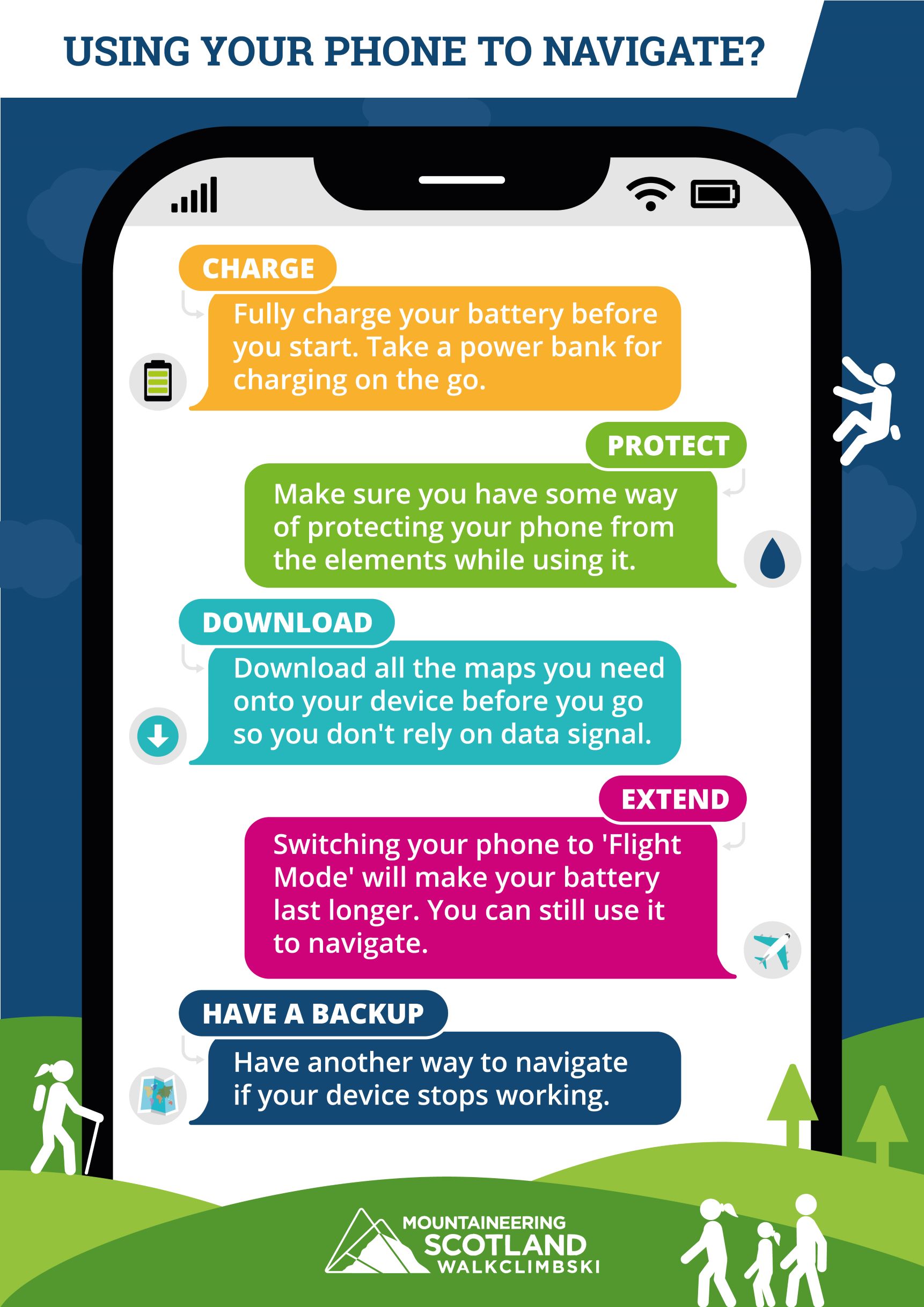
PROTECT � keep your phone in a waterproof case to protect it from the elements, even if it�s rated as waterproof, and keep it close to your body when not in use to keep it warm, dry and help battery life.
DOWNLOAD � download all the maps you might need so you don�t need to rely on mobile data to be able to access maps while you're on the hill. Include maps of the surrounding areas in case you need to change your route, and use a topographic map (eg OS or Harvey Maps) � not all digital maps are suitable for hiking in the hills! If you are planning to follow a route downloaded from an app or website, it's worth checking with other reliable sources of information to make sure it's safe and suitable for your level of experience and ability.
EXTEND - Switching your phone to �Flight Mode� stops it talking to the outside world and makes your battery last a lot longer. The GPS will still work, so you can still navigate. Taking a �Power Bank� and an appropriate cable to link your phone to it, will give you the option to re-charge on the go � this might not work in very wet conditions though!
TAKE A BACKUP - No system is 100% fail safe, so having a separate system to navigate with if the phone or GPS were to fail is a must, for example a map and compass, and a good level of skill to be able to use them. If your phone isn�t working and you can�t use it to navigate, it also means you can�t use it to phone for help either! Having a simple backup phone in the first aid kit with actual buttons and a battery that will last for 6 months switched off is something to consider too.
Using a mobile phone is still useful for many in winter, but it comes with its unique challenges. Being able to do your navigation with a map and compass is the most effective way when the weather is bad, and having your phone warm and working to check or confirm a position can be very helpful and give a confidence boost.
In winter you need to think about the following as well:
For more winter safety and skills tips, visit the ThinkWINTER section.
Occasionally GPS signals are jammed by the military for training purposes. We are sometimes informed of when this is scheduled to happen and include a news story on the website if the jamming is likely to affect hill walkers, though there are also GPS jamming exercises which are not announced.
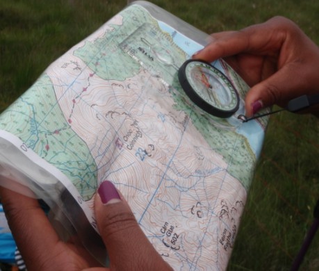
Regardless of which device you choose you should still carry and be able to read a map and understand how it relates to the ground around you.
Even if you have a smartphone or GPS with full OS mapping, it can't read and interpret the map for you. All it can do is show your position - being able to actually interpret the map correctly remains an essential skill. Our preference is still to teach these skills to beginners is using a map and compass to give people a good grounding in the art of navigation.
Having the ability to understand from the map what the terrain will be like, choose suitable routes and be able to make decisions about changing your route if you need to is vital for anyone venturing into the Scottish hills. For example, in the winter, there may be a dangerous cornice where a summer route runs close to the edge of the cliffs above a corrie. Plans may also change, the weather may close in, heavy rain might mean that a burn won't be crossable, there may be an accident. All such eventualities can�t be pre-programmed into a GPS or digital map, so everyone needs to be able to look at the map � whether on paper or a screen � and work out the best way to adjust any route to deal with changing situations.
Every hill and mountain walker needs to learn how to interpret a map, and to navigate effectively using a map and compass, including in poor visibility.
Read more about navigation skills
For those less sure of their abilities, Mountaineering Scotland offer excellent value navigation courses from just �45 including basic skills, night and winter navigation.
Avalanche Transceivers are an important piece of safety equipment that is often carried by off-piste skiers and snowboarders. They work by sending out an electromagnetic signal. This signal can be followed by another devise which is switched to �search� mode in the even of an avalanche. Unfortunately, these signals can become much weaker or harder for the devices to communicate with each other if either transceiver is close to metal or electronic devises, such as:
The advice is to turn off all electronic equipment during your ski tour. If this is not possible, then having all electronic items at least 20cm away from your transceiver while in �send� mode (normal touring mode), but increasing this to at least 50cm when the transceiver is switched to �Search mode�. If you suspect interference during a search, then reducing the search strip widths to 30 meters is advised.

© 2026 Mountaineering Scotland
ClimbScotland is a registered trademark of the Mountaineering Council of Scotland Limited
Mountaineering Scotland is a registered trademark of the Mountaineering Council of Scotland Limited