As regular hill visitors, we know that contour lines are used to illustrate a three-dimensional landscape in a two-dimensional format i.e. a flat piece of paper or on a digital screen.
The cartographers are extremely skilled at achieving this,
illustrating with fine detail the height above sea level and shape of the
topography � that is until it gets steep. When it gets steep, the cartographers
start to struggle, because there physically just isn�t enough space to fit all
the contour lines in.
You will be familiar with the rule of thumb:
This is indeed true, to a point. That �point� being when the
ground is so steep that you can�t fit all the contours in. So, what happens? The
cartographers just miss them out.
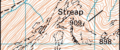
Look at the map extract of Streap. The straight black line covers an area where the contours are widely spaced and there is lots of white showing between the contour lines. At a quick glance you would expect the slope to be fairly easy angled, however, a closer investigation of the contour lines paints a very different picture.
On the OS 1:50000 maps, contours are drawn at 10m contour intervals: i.e. if you go up or down 10m then you would cross a contour line. Every 50m there is a darker and thicker line shown, which is what we call an INDEX contour. So, if the index contours are every 50m then between each index contour there should be four �skinny� contour lines.
So, at this example of Streap, where the black line crosses there are only two skinny lines between the thicker ones, meaning this could potentially be very steep. Combine this with snow or wet rock or grass underfoot and it could prove dangerous. However, at a cursory glance it would be easy to assume otherwise.
In a winter context, we are very interested in how steep a slope is in order to assess the potential avalanche risk � particularly if the slope angle reaches that critical 30 degrees. In summer, 30 degrees is an angle that is steep enough for us to slide or tumble. There�s an easy way to check if your route is going to take you onto this angle of severity: line up your compass ruler between the index contours and if the index contours are 2mm apart or less then the slope is 30 degrees or steeper. (For a 1:25000 map, of course, the critical measure is where index contours are 4mm apart or less.)
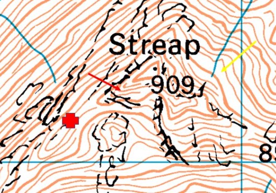
Map extract shows the summit area of Streap.
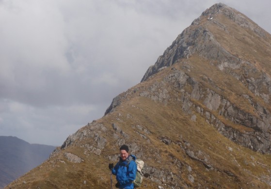
The photo is taken from where the red X is shown on the map, looking up the SW ridge to the summit. You can see on the map that there is one contour missing (only three are shown between the 850m and 900m contour).
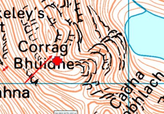
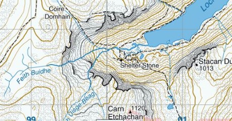
The map shows the Corrag Bhuidhe area of An Teallach. If you study the map carefully, where the red arrow is pointing there are three contour lines missing and only one is shown.
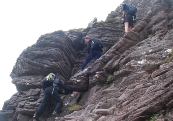
The photograph is taken at the red X on the map and illustrates what this looks like on the ground � definitely a scramble rather than a hill walk. It is also worth noting that what is clearly a craggy area is not shown with crag symbols on the map. The only clue for us on the map that this is very serious ground is the missing contours.
Harvey Maps are available in 1:25000 and 1:40000 scale, and the contour intervals on both these scales of maps are 15m, with index contours every 75m. A useful added feature of Harvey maps is that the shading of contours changes from brown to grey when an area is predominantly rocky ground. An example of this is shown here.
It is also possible in your planning stage to establish the angle of slope between the index contours on Harvey Maps. Sadly the measurements for this scale and contour interval don�t exactly role off the tongue. A 30 degree slope or steeper would equate to 3.24mm between index contours on a 1:40000 map and 5.20mm for a 1:25000 Harvey Map.

© 2026 Mountaineering Scotland
ClimbScotland is a registered trademark of the Mountaineering Council of Scotland Limited
Mountaineering Scotland is a registered trademark of the Mountaineering Council of Scotland Limited