You�ve done as recommended and checked the mountain weather forecasts covering the area for your planned journey.
But what does it all mean?
You shouldn�t make plans and then look at a forecast just to see what weather you�re likely to get: you should use the forecast to make your plans. Depending on the forecast you may even completely change your plan and head west rather than east, or vice versa, to take advantage of the best conditions.
Whether or not it�ll rain and if it�ll be sunny are probably what most people look at, but the forecast will tell you much, much more.
A major factor is the wind. How strong is it? What direction is it coming from? Is it easing or strengthening as the day wears on?
In a strong wind � and anything over 35mph will affect the balance of a fit, strong adult � you may want to avoid narrow ridges, or tricky terrain where losing your footing could lead to injury. You will want to have the wind behind you as much as possible, so the wind direction may well affect your own direction of travel. If it�s strengthening throughout the day you might decide to go high in the morning and walk out lower in the glen, while if the wind is easing you may decide to walk through the glen in the morning and return over the hill in the afternoon when the wind will be less.
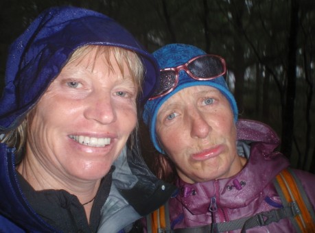
Wind also combines with rain to make very unpleasant conditions, especially if you are trying to walk into the wind. Even in summer hypothermia can be a danger in these conditions.
Find out more about the effects of windspeed in the mountains.
Rain�s not a showstopper the way wind can be, and with a good set of waterproofs (jacket and trousers) there�s no reason you can�t enjoy a good day out on the hills. But heavy or prolonged rain can have a big effect on river and stream levels, making them harder or even impossible to cross. So make sure you make allowances and remember: a stream which you crossed on the way out may be completely impassable by the time you return. If there has been heavy rain, or heavy rain is forecast, it is wise to plan a route that either utilizes bridges or crosses glens high up at the watershed.
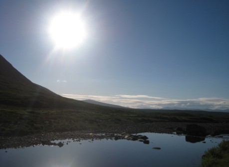
Okay, it seems it doesn�t happen often enough, but when the sun does come out remember to slap on the sunscreen � and remember to replace it through the day. In warmer weather you need to make sure you drink enough too to keep your fluid levels up. You lose more fluid than you think when you sweat. Remember, though, fluid is heavy (1 litre = 1kg), so the best plan is usually to carrying one litre of liquid and top up from mountain streams. Read more tips on coping with the heat.
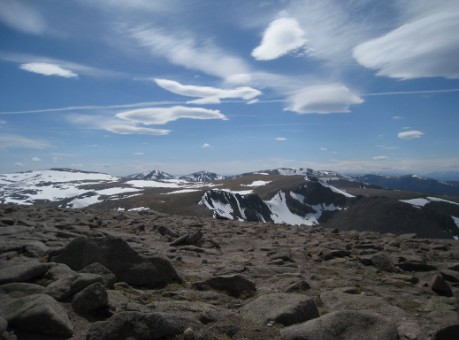
Even in summer it can be cold enough for snow to fall on the tops, so don�t assume that because the sun is shining in the glens it�ll be just as warm on the tops. Temperature generally decreases with height, and the reduction can be considerable. Mountain-specific forecasts will give you the expected temperature at Munro height, so you�ll know what to expect and how many additional layers to carry.
Once you switch on to the idea of using the weather forecast to make your plans you realise how much useful information there is � and you increase your chances of having a good day out, because you�ve gone where there�s the best chance of usable weather and you�ve planned your route to take best advantage of that weather.
The most commonly used mountain weather forecasts are the Mountain Weather Information Service (MWIS) and the Met Office, and it really is worth checking both.
MWIS is good for getting a general picture of the weather over a wide region for the current day and two days ahead. The Met Office forecast allows you to drill deeper down for more precise information, getting a forecast for a specific hill and on how the weather is expected to change in three-hour intervals through the day. That detail is great for detailed planning, but sometimes it�s harder to get the general picture which you can get from MWIS, which also has useful commentary on the effects of the expected weather.
You can read more about weather forecasts and find links to alternative mountain forecasts here.
You can learn more about mountain weather and how it affects you and your route plans through a practical mountain weather workshop being run in association with MWIS this Spring.
© 2026 Mountaineering Scotland
ClimbScotland is a registered trademark of the Mountaineering Council of Scotland Limited
Mountaineering Scotland is a registered trademark of the Mountaineering Council of Scotland Limited