For most people, jumping in a car is the easiest and most obvious mode of transport when heading off to the mountains. But for those who fancy trying something different, why not consider using buses, trains or bikes to add a bit more adventure to your trip? We�re lucky to have rail and bus networks throughout Scotland which reach some of the most remote areas - and using public transport is also another way to make sure you do your bit for the environment.
Don�t forget that buses and trains can also be an advantage if you�re planning to do a long-distance or non-circular walk, taking away the hassle of either lengthy treks back or the need for multiple cars. Some great examples would be to take the train to Blair Atholl and walk through Glen Tilt and Glen Feshie before catching the train again at Kingussie or Aviemore, or why not jump off a train at Dalwhinne, traverse the Ben Alder hills then catch the train home at Corrour?
There�s a huge number of routes that work well with public transport and we�ve pulled together 12 of the best from the Walkhighlands website to help you get started.
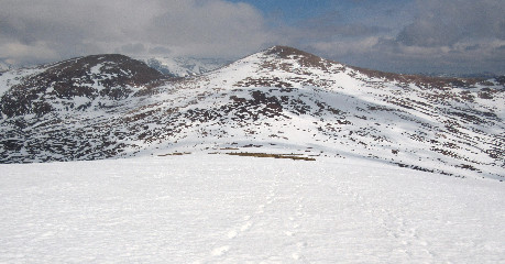
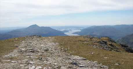
Offering great views of the Torridon giants, Fionn Bheinn sits alone at 933 metres. A bus or train can easily be taken to Achnasheen to start this walk, which begins right next to the train station and bus stop. Take the old road over the stone bridge and follow the footpath signs until you begin to ascend a grassy hillside before heading towards Creagan na Laogh. From its flat top, head north until you reach the main ridge of Fionn Bheinn before climbing to the summit.
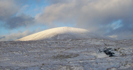
Fionn Bheinn, by Jennifer Cardno.
Take the train or bus to Fort William and a bus service runs between May and September for those looking to tackle all 1345 metres of Britain�s highest mountain. A well-worn path takes walkers directly to the summit for fantastic views across much of the Highlands. But don�t be fooled by the misleadingly named �tourist� path; the walk is long, steep and strenuous and still requires appropriate equipment and preparation.
Ben Nevis, by Alan Rowan
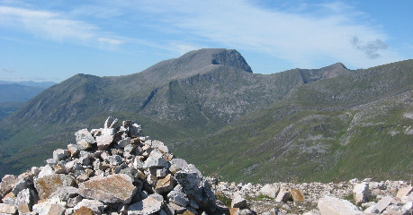
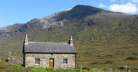
One of Scotland�s more remote Munros at an altitude of 1148 metres, Ben Alder can be approached a number of ways from various directions. One option is to take a train to Dalwhinnie and cycle the 15km to camp near Culra bothy, which is currently closed due to asbestos. This route takes walkers to Ben Alder�s summit via the Long Leachas ridge which involves some simple scrambling. From here, head around the plateau edge for a short time before descending the Bealach Breabag to return to Culra, or follow a faint path up Sron Coire na h-lolaire to reach the summit of Beinn Bheoil.
Ben Alder, by Stuart Stronach
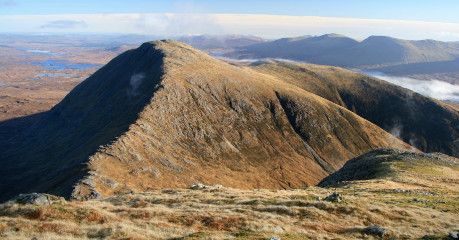
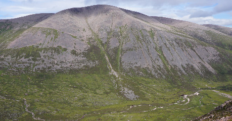
Rising steeply to the south of Crianlarich, Cruach Ardrain�s route begins from forestry land just a short walk from Crianlarich train station. At 1046 metres, this Munro is a fine climb on its own or with its neighbour Beinn Tulaichean. Follow the track which leads to Coire Earb before reaching Grey Height then follow the ridge to Cruach Ardrain before returning the same way or extending the route to Beinn Tulaichean.
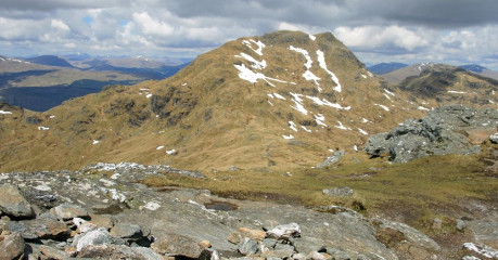
Cruach Ardrain from Beinn Tulaichean
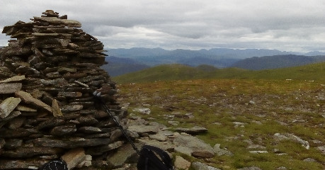
As the most remote train station in Britain, Corrour is a fantastic place to start a mountain adventure. A short walk from the station begins the route past Meall na Lice to the summit of C�rn Dearg before crossing the saddle to Sg�r Gaibhre for wonderful views of Ben Alder, Schiehallion and a number of other Munros and Corbetts.
Sgor Gaibhre from Carn Dearg, by Alan Rowan
Take a bus or a train to Bridge of Orchy then pass under the railway line on the West Highland Way path to begin the walk to one of the southern Highlands� most recognisable Munros. Follow the path up to the bealach at 744 metres before climbing southwards to the summit of Beinn Dorain at 1076 metres then return along the ridge to reach the path for its neighbour Beinn an Dothaidh.
Beinn an Dothaidh, by Alan Rowan
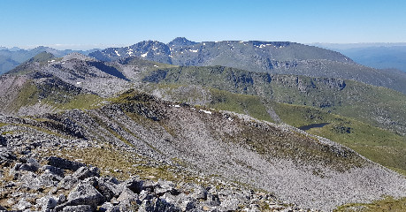
Its narrow, rocky ridges and steep scrambly ascent make Stob Ghabhar one of the best Black Mount summits and a familiar sight from Rannoch Moor. Take a train to Bridge of Orchy railway station then cycle just under 6km to Victoria Bridge where the walk begins. Stob a�Choire Odhair is reached first at 945 metres before following the west ridge down to the bealach then climbing steeply to reach Stob Ghabhar at 1087 metres.
Stob a' Choire Odhair from Stob Gabharn
A train to Spean Bridge then a short cycle will be needed to begin this walk which starts at a rough track near Corriechoille. Taking in three Munros (Stob Coire Claurigh, Stob Coire an Laoigh and Sgurr Choinnich Mor), this is a popular group of hills to the east of the Nevis Range. Traverse the main ridge to reach all three summits for a demanding but fantastic day out.
The Grey Corries, by Stuart Stronach
With great views over Loch Lomond, the route to Ben Vorlich is normally climbed by a steep ascent from Loch Sloy but can also be started from Ardlui train station. This alternative route ascends by the Little Hills ridge and descends the Stob nan Coinnich Bhacain ridge to the north east.
The view from Ben Vorlich, by Jennifer Cardno
Although lacking the sharp-pointed drama of western ranges, the Monadhliath range is great walking country that offers a real sense of remoteness. Taking in three Munros (Carn Dearg, Carn Sgulain and A�Chailleach) the route can be reached from Newtonmore by bus or train and follows a ridge to the first summit before crossing a plateau to reach the other two.
From the summit cairn on A'Chailleach, by Jonathan Binny
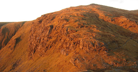
Starting from Achnashellach train station, this steep walk follows a long ridge to take in Beinn Liath Mhor with the option to add Sgor Ruadh as an extra summit for those looking for a longer day. A forestry track starts the route before a path begins to climb revealing views of the Achnashellach Estate. Eventually the ridge is reached to climb to the summit of Beinn Liath Mhor at 924 metres. On descent, a lochan is reached on the bealach which allows an ascent of Sgor Ruadh.
Sgor Ruadh, by Alan Rowan
The second highest mountain in Britain, Ben Macdui sits at an impressive 1309 metres. With easy bus access from Aviemore train station to the Cairngorm Ski Centre, this route can get off to a quick start. Although faster to climb the ski track to the plateau, a more scenic route involves heading across below the northern corries before the path curves along the slopes of Cairn Lochain followed by a long but gradual climb to the summit. For those with an extra burst of energy, heading east from Cairn Lochain will take you along the tops of the Northern Corries and up to the summit of Cairn Gorm.
Ben Macdui, by Neil Reid
This selection was compiled by Mountaineering Scotland volunteer Lynsey Macready.
The Car Free Walks website also has hundreds of routes accessible by bus, train and ferry, in Scotland as well as England and Wales.
© 2026 Mountaineering Scotland
ClimbScotland is a registered trademark of the Mountaineering Council of Scotland Limited
Mountaineering Scotland is a registered trademark of the Mountaineering Council of Scotland Limited