Friday 23rd May 2025, 9:00am
Taken from Scottish Mountaineer issue 101, 'Scotland's Best Walks' is a regular feature run with Scottish Mountaineering Press where we detail some of our team's favourite walks across Scotland.
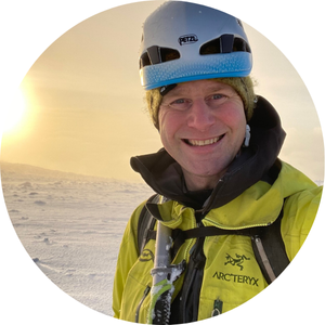
This time, we've got Max Hunter's (Mountain Safety Advisor) favourite walk, Sg�rr nan Gillean.
"I was excited. I was about to complete my first solo week in Scotland, a trip to the Cuillins on Skye. It was 1996, and I was following a thin and vague guide to the Munros of Skye, that I�d found in a garage shop. I was on day six of the four day guide - it had taken a week, but I was about to complete the guide. My last day was to be the northern Munros of Brauch na Frithe, Am Basteir and Sgurr nan Gillian.
I�d learnt how difficult the navigation was; the 1:25,000 map wasn�t very helpful, and the compass pointed in all directions. Now I needed to put my week of experience together to complete the northern three.
I found my diary notes from this week, and it�s been fun reading it back. My notes state about Am Basteir �it was hard�, and my notes about Nicholson�s Chimney to Sg�rr nan Gillean say �Blimey Hard�. This was before I knew about the scrambling or climbing grading system, apparently there was no �Blimey Hard�!
I got to the top of Sg�rr nan Gillean, and had the top all to myself, in fact I�d had the ridge to myself for the entire week! It was a really special moment, which I still remember today. I took a moment to reflect on my week, and this memory has stayed with me. The top is airy and sensational. I left the top, I followed my �guide� to descend the SE ridge. I went on to climb Sgurr Beag and Sgurr na h-Uamha, before finding the path down and back to my car at Sligachan, which was the only car there! Skye wasn�t busy then.
Back home in England, days later, I tried to share my experience on Skye, but nobody understand or appreciated what week I�d had. I stopped trying to explain, and just keep it for myself - but I knew I�d be back and needed more. I now live in Fort William."
Peak of the young men, or more probably peak of the gullies
Height: 964m
Lay-by at Sligachan on the Dunvegan road: 57�17'21.8"N 6�10'33.6"W
Starting point: NG484296
Details: 12km/985m/5-7hrs
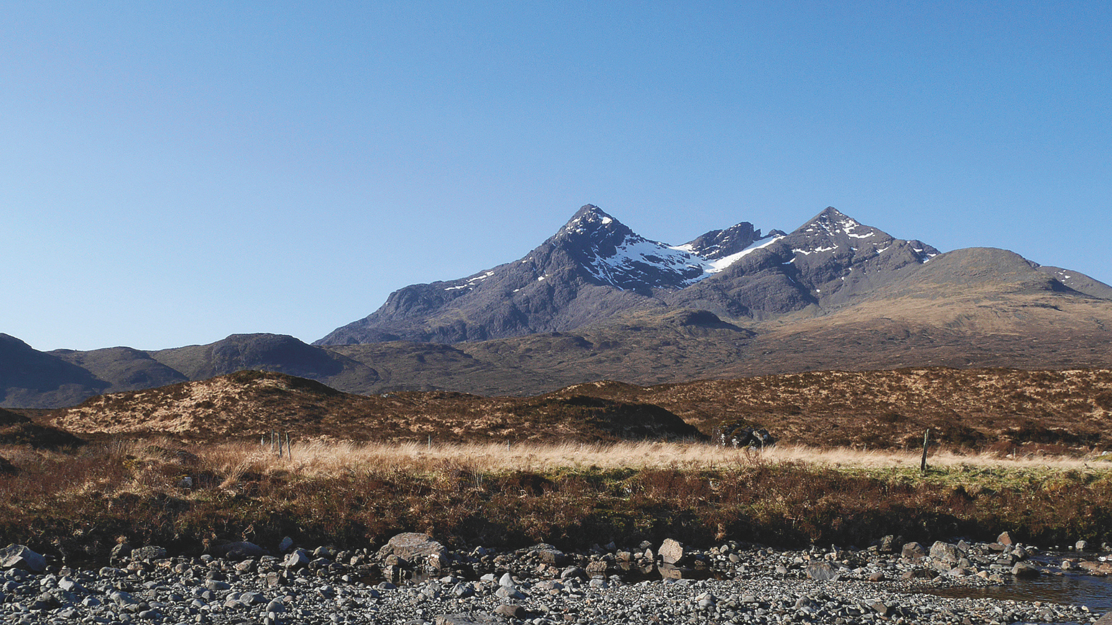
Probably the most familiar peak of the Cuillin, Sg�rr nan Gillean�s prominent pointed summit, flanked by its neighbours Am B�steir, the Basteir Tooth and Sg�rr a� Bh�steir, provides a classic first sight of this magnificent mountain range when seen from the A87 beside Loch Sligachan. However, this view fails to fully reveal Sg�rr nan Gillean�s true majesty, for its finest feature, the jagged saw-toothed Pinnacle Ridge, which rises dramatically to its summit, as depicted in the classic picture-postcard landscape, is only seen end-on.
The ascent of Sg�rr nan Gillean, the first recorded ascent of a Cuillin peak, took place in 1836, when Professor James David Forbes, the physicist and Alpine pioneer, was guided to its summit by local forester Duncan MacIntyre. The route they took is the easiest of three narrow rocky ridges that lead to the top and has earned itself the misnomer of the Tourist Route. This south-east ridge is certainly not a route for tourists, or for anyone without a head for heights and some scrambling ability. Some may require the security of a rope for the final rocks, which require exposed Grade 2-3 scrambling.
The featureless nature of the lower ground, the rugged and precipitous terrain higher up, and the final awkward moves to attain the exposed summit, all serve to make this a fairly serious outing for even the most seasoned of hillwalkers. As a result, the summit is one of the most highly sought after in the country. Many opt for the services of a professional guide or a friend with rock climbing skills and a rope to take them up Sg�rr nan Gillean and the adjacent Am B�steir. This is usually achieved as a circuit via Sg�rr nan Gillean�s west ridge, which rises from the Bealach a� Bh�steir, below Am B�steir, thereby dealing with two of the slightly more scary and problematic Cuillin peaks in one go!
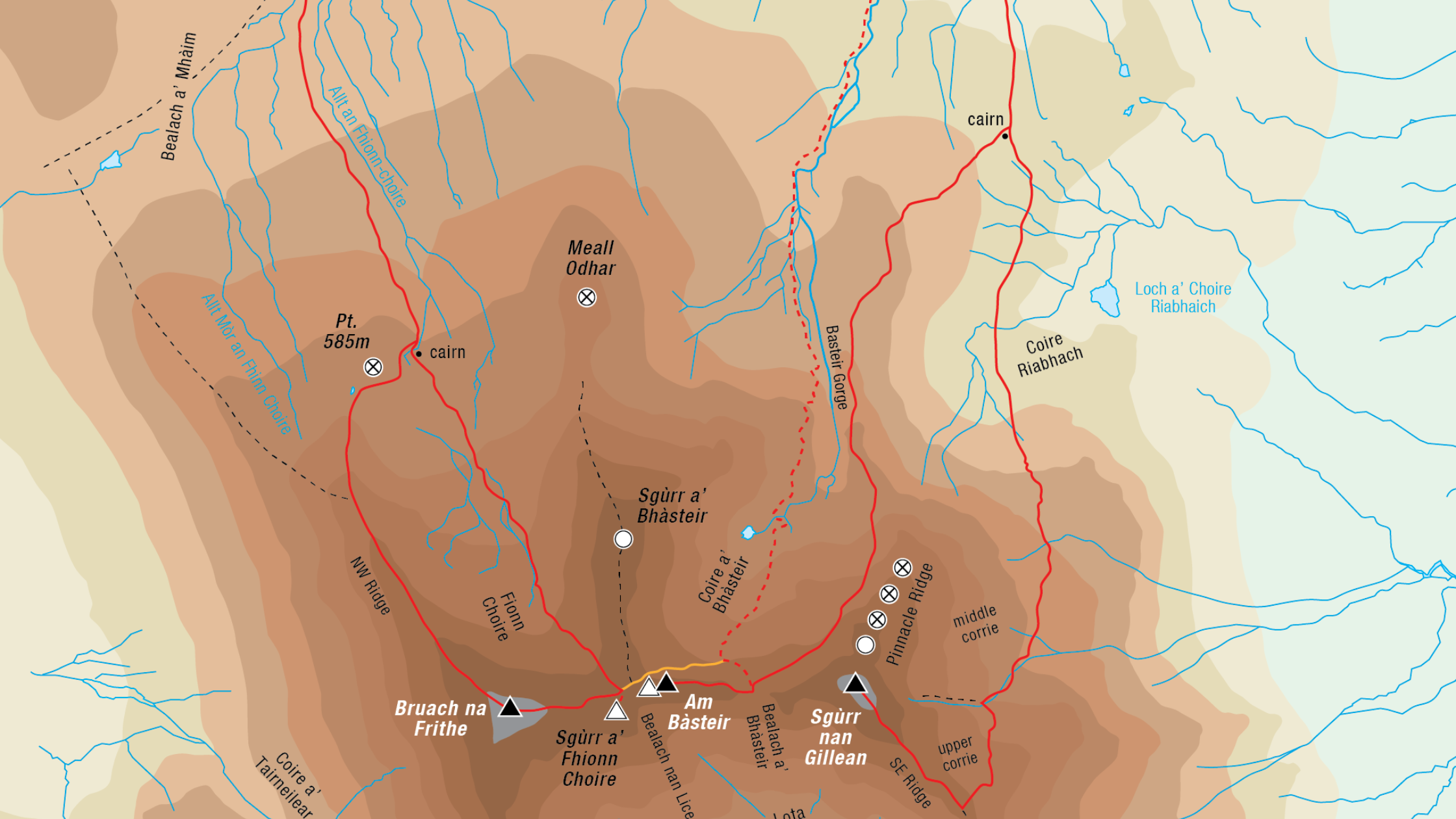
However, the description here is for an ascent of Sg�rr nan Gillean alone, by the south-east ridge. The ascent starts from near the Sligachan Hotel, which stands at the junction of the A87 to Portree and the A863 to Dunvegan and Glen Brittle. Park on a section of old road and rough layby at NG484298, about 150m west of the hotel on the north side of the Dunvegan road. The parking can become crowded, so ensure the gated entrance to the Sligachan Mountain Rescue Base on the old road is left clear.
From the top end of the parking, cross the road and follow the path to a bridge over the Allt Dearg M�r. Cross this, continue on the moorland path for 1.5km to reach the Allt Dearg Beag, and follow its west bank for 240m to a plank bridge, where the path divides. Cross the bridge and ascend south to reach a cairned highpoint overlooking Coire Riabhach, where the path to Bealach a� Bh�steir and Am B�steir breaks off right and ascends towards the foot of Pinnacle Ridge.
Drop slightly into lower Coire Riabhach, cross the floor of the corrie, then climb more steeply over increasingly rocky and stony ground to gain a shallow subsidiary corrie, middle Coire Riabhach, below the pinnacles of Pinnacle Ridge. Cross the corrie to where it ends at a rocky ridge and a wide scree and boulder-filled gully containing a burn that flows down from the foot of Sg�rr nan Gillean�s east face, directly above.
Do not cross the burn, but ascend beside it on an increasingly obvious path towards a large arrow-shaped overhang about halfway up the gully, from where a rocky ramp on the left is climbed to its top, NG476251, on the edge of upper Coire Riabhach. This upper corrie is a featureless place, littered with big boulders, and finding the best route through it requires care, especially in poor visibility. Ascend leftwards to avoid as much bouldery ground as possible, then zigzag up scree paths to a small col on the south-east ridge at NG474250.
Scramble up the crest of the ridge or follow the path on its right side, towards steeper rocks breached on their left by a short scramble up a narrow slot with an awkward exit. Above this, continue weaving up through rocky steps to the final rocks of the summit tower. There are now two options.
(i) Ascend a short corner on the frontal prow, followed by an exposed slab leading to easier ground before the final narrow summit ridge
(ii) Skirt the initial summit rocks via slabby rock ramps to the left, then gain sloping slabby ledges below a tower-like block on the skyline and ascend via some awkward steps to easier ground before the final summit ridge.
Either way, the final narrow horizontal section is incredibly exposed and often nervously shuffled across by various means to gain this most fabulous and airy of summits (6km; 960m; 3h 15min). It is worth sitting down awhile to take in the extraordinary situation and the impressive view down the west ridge to Am B�steir and Bruach na Frithe, as well as composing oneself for returning the same way.
If descending in poor visibility, care will be needed to find the cairned start of the rampline connecting upper Coire Riabhach with the middle corrie below (12km; 970m; 6h).
Route description, map and image taken from The Munros (SMC), written by Rab Anderson & Tom Prentice. For more information, visit: www.scottishmountaineeringpress.com
© 20/0 Mountaineering Scotland
ClimbScotland is a registered trademark of the Mountaineering Council of Scotland Limited
Mountaineering Scotland is a registered trademark of the Mountaineering Council of Scotland Limited