Friday 9th May 2025, 9:00am
Taken from Scottish Mountaineer issue 99, 'Scotland's Best Walks' is a regular feature run with Scottish Mountaineering Press where we detail some of our team's favourite walks across Scotland.
This time, we've got Stuart Younie's (CEO) favourite walk, Ben Rinnes.
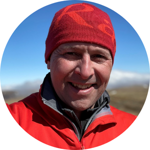
�I have unashamedly picked a hill that�s local to where I grew up in Moray. Although classified as a Corbett, it�s a very easy and accessible hill thanks mainly to the hard work of the Friends of Ben Rinnes, in co-operation with the two local estates, who have done a great job upgrading the path over many years.
On a recent visit, I was delighted to see that Moray Council have extended the car park to meet the increasing demand from people who want to climb this very popular viewpoint. On a clear day the 360-degree panorama is grand, and the summit tor provides a Cairngorm-like experience right in the heart of malt whisky country. So, after your hike you can visit one of the many world-famous distilleries located nearby, take a stroll along the River Spey in Aberlour, have a coffee at the Sidings Cafe in Dufftown and take a trip on the heritage railway, affectionately referred to as the �dram tram�. Enjoy, slainte!�
Possibly from Old Irish rind, meaning a headland, giving rise to Headland Hill. Alternatively, Beinn Ruaidhneis is sometimes suggested, possibly Hill of the Red-brown Plain.
Height: 841m
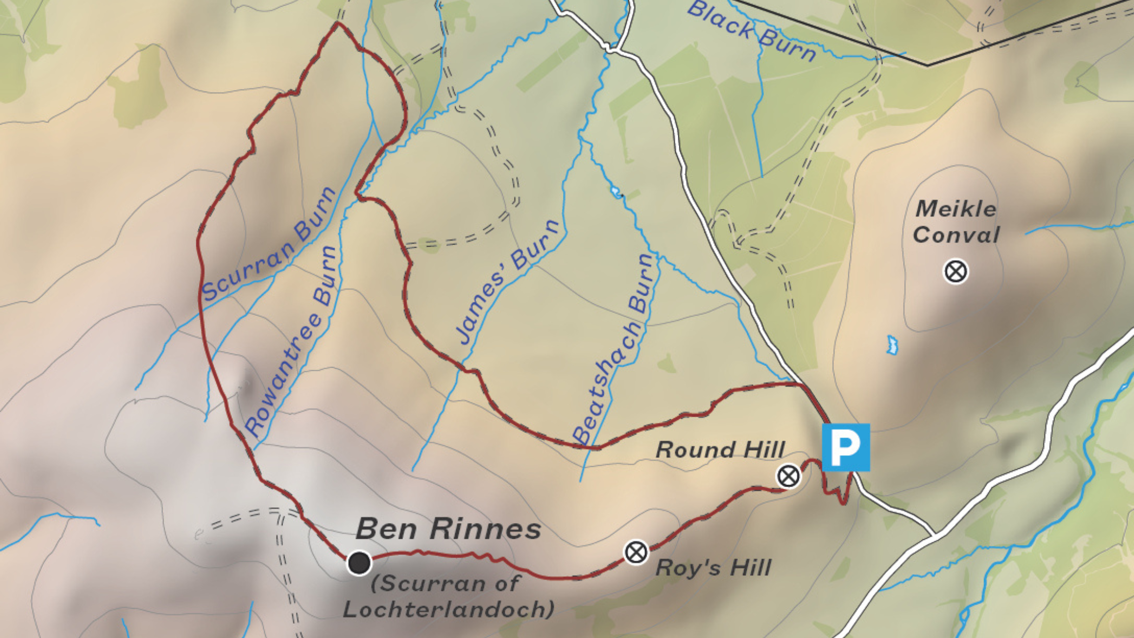
Ben Rinnes Car Park: 57.408333 -3.192222
Starting point: NJ 2550 3544
Details: 13km/620m/4hrs
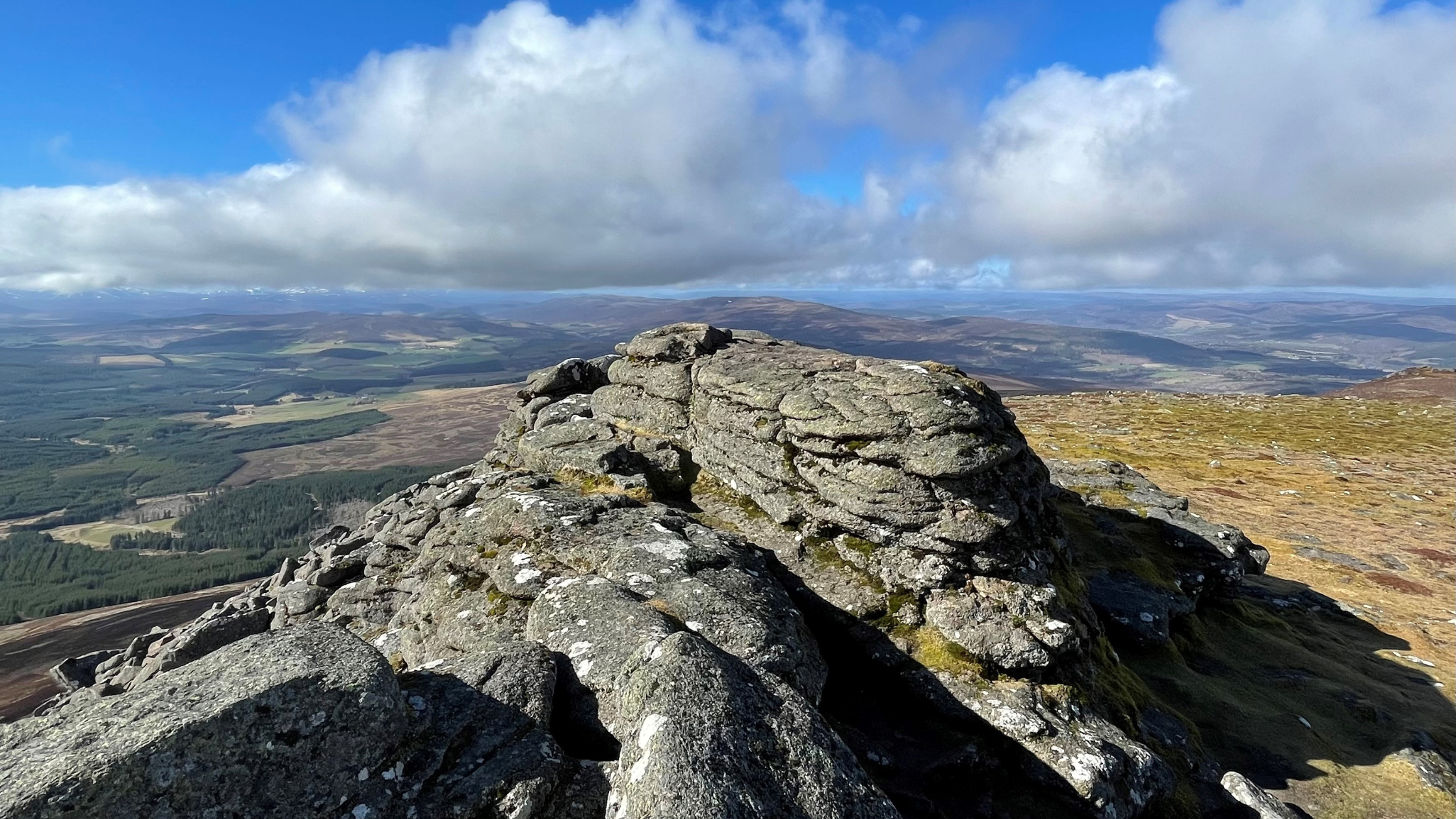
Ben Rinnes dominates the lower reaches of Speyside and when viewed from the Cairngorm plateau, or across the Moray Firth from the north-west, it is seen as a beautifully shaped conical peak. The hill is made even more distinctive by the large granite tors at its top known, as the Scurrans (a diminutive of �sgor�). It is an extremely popular hill with a good path up the east ridge and extensive views from the summit across Moray and Aberdeenshire towards the hills of Caithness.
Start from the minor road connecting Glen Rinnes to Edinvillie in Strathspey, where there is a small carpark. A wide, steep track leaves the car park and heads west over Round Hill and then gently rises to cross Roy�s Hill. A well-worn path leads across a flat section before climbing steeply to the summit. There is a trig point, but the actual summit is a granite tor called the Scurran of Lochterlandoch.
The summit area is studded with tors which are well worth exploring even if returning by the route of ascent. It is possible to make a longer return by heading north-west then north from the summit, passing the large tors of the Scurran of Well. From there either continue in a wider loop over Baby�s Hill as shown on the map or descend directly downhill in a north-easterly direction. This latter option is rough going and trackless. Either way, an estate road is reached; turn right and follow it as it contours around the hillside back to the road near the parking area.
© 27/0 Mountaineering Scotland
ClimbScotland is a registered trademark of the Mountaineering Council of Scotland Limited
Mountaineering Scotland is a registered trademark of the Mountaineering Council of Scotland Limited