Wednesday 3rd August 2016, 1:42pm
Hill walkers, climbers and runners are being asked to avoid certain areas on Ben Nevis next week because of extensive geological and botanical surveying taking place.
This is the third and final year of Nevis Landscape Partnership�s ambitious project to create a comprehensive geological and botanical map of The Ben, and it will involve access work on different areas of the North Face from Monday, 8th to Friday 12th of August.
Working with geology experts from Midland Valley and using innovative digital mapping has made surveying areas previously thought inaccessible a reality. The use of mountain guides to set up rigging and big abseils into dark, previously unexplored nooks and crannies has also benefited the British Society of Botany and resulted in multiple new population discoveries in year one and two.
The main areas the team will be focusing on this year will be Observatory Gully, Orion Face and the Little Brenva Face. Due to the risk of rock-fall the team have asked the general public to avoid these areas. The team will be using fixed rope anchors along the edge of the summit plateau and for the safety of those working below they ask that all ropes and anchor points are avoided. The whole North Face is likely to be scattered with scientists, mountain guides and Nevis Trainee Rangers who will be assisting throughout the week. Normal access to and from Ben Nevis� summit via the mountain track will not be affected nor will access to The CIC Hut via Torlundy.
Year one was captured in Dave MacLeod�s film �The Hidden Side� which Nevis Landscape Partnership financed as part of a separate project to share this project with the general public. You can take a look over on Nevis Partnership Vimeo channel, and reports on the first two phases of the project can be found on Nevis Landscape Partnership�s website along with numerous articles regarding year one and two.
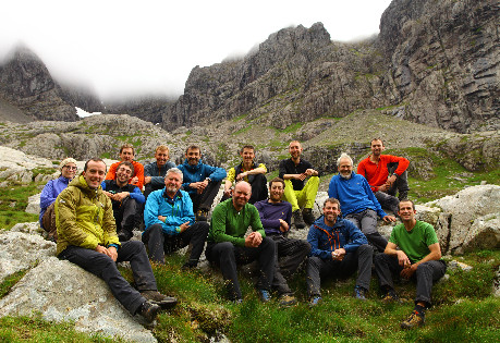
The North Face Survey Team. Photo by Dave MacLeod
© 10/0 Mountaineering Scotland
ClimbScotland is a registered trademark of the Mountaineering Council of Scotland Limited
Mountaineering Scotland is a registered trademark of the Mountaineering Council of Scotland Limited