Thursday 5th March 2026, 9:00am
When the mountains are covered in snow, interpreting contours and features can be far more challenging. Along with the reduced visibility at times and shorter daylight hours, navigating in winter can be far more difficult than in the summer months.
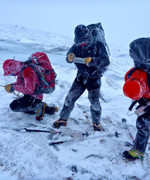
Taken from Scottish Mountaineer 104. By Scott Kirkhope, Development Officer for the Association of Mountaineering Instructors.
In this article, I'm not going to teach you how to navigate
in winter. If you're looking to learn the skills to navigate, I recommend a
practical course with a qualified instructor. Any member of AMI who holds the Winter
Mountain Leader or the Winter Mountaineering and Climbing Instructor is
suitable to offer this.
Instead, let�s focus on some practical tips that will help
you prepare and sharpen your skills for winter, whether you�re using a map and
compass or a phone.
Navigation, like many mountain skills, needs regular practice. If you're not using the navigation on a year-round basis, using these skills when needed in winter is going to be challenging. Spend some time in autumn, or on lower, familiar hills, re-engaging and getting comfortable and efficient at the basics again.
I like to use autumn outings as a chance to stay hill-fit and refamiliarise myself with essential techniques, either whilst trail running or out bagging some Munros. You don�t want your first whiteout on the Cairngorm plateau to be the first time you�ve tried to pace 400 metres on a bearing, with serious consequences if you get it wrong.
Take the time to practice the skills required for navigating in a whiteout in challenging conditions, such as:
Don�t leave these skills to memory - refresh them so they�re second nature when conditions turn challenging.
All your winter adventures should involve some BAA planning. Make note of important legs of your route (for example, from your summit down the correct ridge, or from the top of your winter climb/crag) and consider taking the bearings and measuring the distances at home. Just enough to get you to somewhere of more relative safety or to a bigger more identifiable feature.
Write these down either on your map or on waterproof paper and keep them with your map, or pre-program them into your phone (make sure the map area is downloaded for offline use). Pre-planning can eliminate the stresses and potential mistakes you may make whilst doing it on the hill.
Full-size 1:50,000 maps can be awkward in winter winds. Cut, fold, or print just the section you need so it fits easily in a pocket and can be handled quickly without faff, remember to keep in a waterproof cover.
Have a way to attach them to your jacket or rucksack with thin cord and/or a small carabiner, long enough to hold the compass at arm�s length when walking on a bearing. That way, they won�t blow away or dropped when you�re working in bad weather with winter kit on.
If you�re using a phone, especially as your primary navigation tool, look after it and maintain battery life as much as possible:
A touchscreen stylus attached to your case can make life much easier than trying to operate the screen with bulky, damp, or frozen gloves, or worse still, having to remove them altogether to use your phone.
I personally prefer to use map and compass as my primary method, especially if I know I am going to be doing of navigation. I will only usually use my phone for short sections of the day or to confirm where I am before I move onto a new leg.
Using a device such as a phone or GPS can be efficient but remember, they do not remove the need for understanding and reading the map that is on the screen. You still need to be able to identify features and hazards such as steep slopes, cliffs etc.
The best way to feel confident in your winter navigation skills is always to practice and prepare. If you�d like to take your skills to the next level, book onto a winter navigation or winter skills course with a qualified AMI instructor via Mountaineering Scotland. You�ll get expert guidance, a safe environment to practise in, and build confidence in exploring the hills in challenging conditions.
© 18/0 Mountaineering Scotland
ClimbScotland is a registered trademark of the Mountaineering Council of Scotland Limited
Mountaineering Scotland is a registered trademark of the Mountaineering Council of Scotland Limited